FORESTRY UAV PROGRAM
The Forestry UAV Program promotes a conduit for ground-based research to combine with technology to provide broad scale evaluations of habitat management, vegetation health, species detection and abundance, wildland fire impacts, climatic conditions, and offers youth engagement. The utilization of 4 UAV platforms with RGB, thermal, multi-spectral, and Lidar devices coupled with GIS programs allow evaluations of plant health, habitat characteristics, and management impacts. The combination of scientific data collection, tribal knowledge, and habitat data provide improved predictions of management, climatic, and natural forces impacts on tribal lands.
Mission:
The program’s mission is to implement cultural and science-based management strategies that promote the sustainable use and resiliency of Tribal resources.
Program Tasks:
- Species Detection
- Habitat Monitoring
- Youth Involvement
- Invasive Plant Treatment
- Wildland Fire
- Climatic Conditions
- Vegetation Health
Key Projects:
- Ortho-mosaics
- Vegetation indices
- Thermal wildlife detection
- Thermal monitoring of wildland fire
- LiDAR elevation measurements
- Invasive species detection
- Native species detection
- Forest structure change
- Vegetation response to drought and flood
The Forestry UAV Program: Photos/Highlights
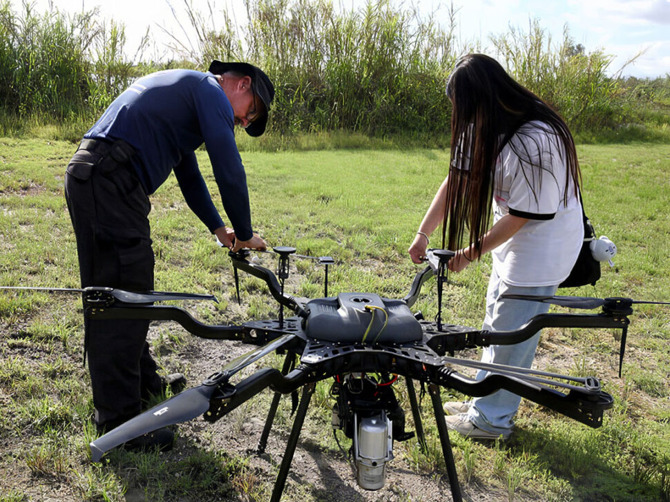
Providing tweaks to the drone in the field.
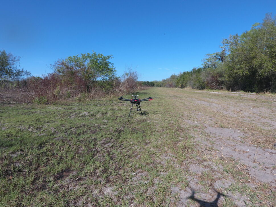
Testing a drone in the field.
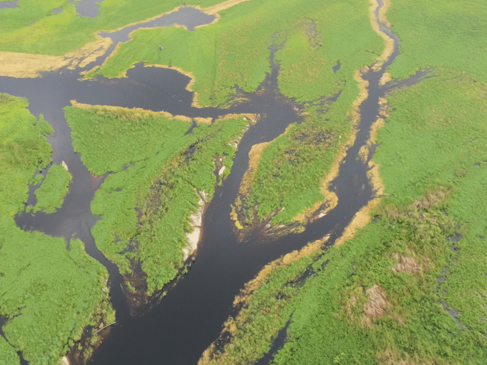
An aerial view from the drone of Kissimmee Billie Slough.
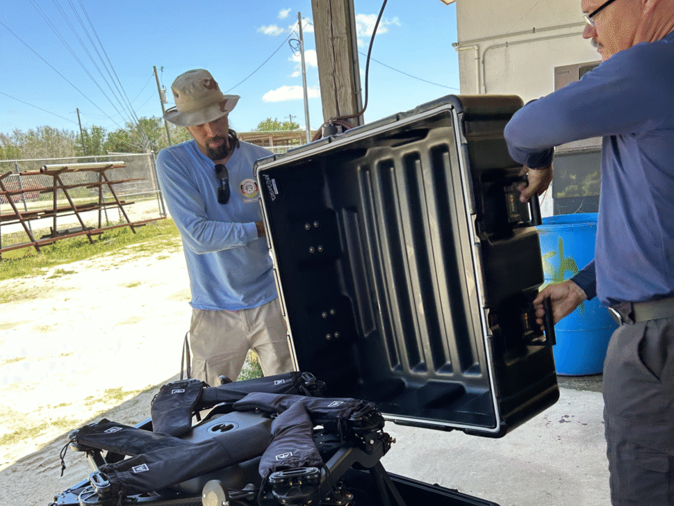
Unboxing a newly acquired drone.
ENVIRONMENTAL PROTECTION OFFICE
Dr. Paul N. Backhouse
Environmental Resources Department
Whitney Sapienza | Director
Department of Conservation
Dr. Craig van der Heiden | Director
External Environmental Compliance
Stacy Myers | Director
Water Resources
Alfonso Tigertail | Director
PHONE
(954) 966-6300
ADDRESS
1601 NW 136th Avenue,
Suite A100, Sunrise, FL 33323